 OSU OREME catalogue
UMR Géosciences Montpellier (GM)
Contact for the resource
Provided by
GEMET keywords
INSPIRE themes
Keywords
Years
-
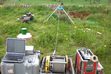
Data from the 'Hydrogeophysics in drilling observatory' (FORAGE): In-situ study of subsurface dynamics using multi-parameter and multi-method drilling observations: imaging and temporal monitoring of geophysical, hydrogeological and hydrogeochemical parameters.. This observatory is part of the Montpellier Research Observatory of Environment (OSU OREME, oreme.org). It is labelized in the framework of SNO H+.
-
Flowrate data from the Larzac observatory (SO GEK) hosted by the Mediterranean Research Observatory of Environment (OSU OREME, http://www.oreme.org) and the National hydrogeological sites network (SNO H+, http://hplus.ore.fr/). Data are measured on La Bise site (L'HOSPITALET-DU-LARZAC, AVEYRON, France) and Les Baumelles site (LA COUVERTOIRADE, AVEYRON, France) and Les Canalettes site (NANT, AVEYRON, France) and Titou site (LA COUVERTOIRADE, AVEYRON, France).
-
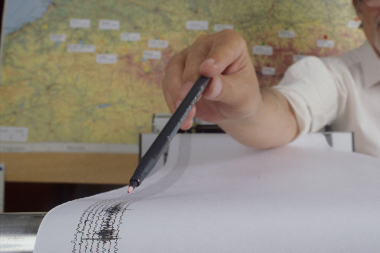
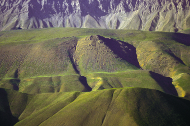
Data from the 'Seismic hazard' (ALEA): Acquisition, processing and provision of observations and databases used to define seismogenic sources in seismic hazard models. This observatory is part of the Montpellier Research Observatory of Environment (OSU OREME, oreme.org). It is labelized in the framework of Action Transverse Sismicité Epos-France. It consists in different observing tasks: FACT ; FMHEX.
-
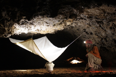
Data from the 'Larzac observatory' (GEK): Study of the spatio-temporal variations of the water stock in karst environments (Larzac): temperature, water flow, gravimetry, GPS, inclinometry, water vapor, CO2 flow, .... This observatory is part of the Montpellier Research Observatory of Environment (OSU OREME, oreme.org). It is labelized in the framework of SNO H+.
-
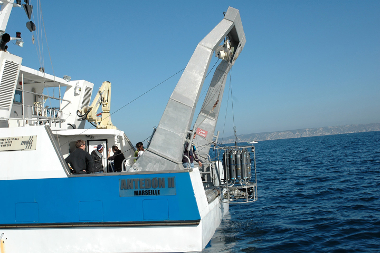
Data from the 'Monitoring of marine currents in the coastal area' Observing Task, part of the Thau coastal environment research observatory (REC-THAU) Observation Service of the Montpellier Research Observatory of Environment (OSU OREME, oreme.org).
-
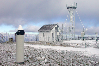
Data from the 'Southern seismic broadband network observatory' (RLBP): Broadband seismic data for the measurement of soil deformations over a range of time scales (second -> decade).. This observatory is part of the Montpellier Research Observatory of Environment (OSU OREME, oreme.org). It is labelized in the framework of SNO RESIF-RLBP.
-
Data from the 'National network of repeated absolute gravimetry' (GRAVI): Network of absolute gravimetric sites repeated over time. This observatory is part of the Montpellier Research Observatory of Environment (OSU OREME, oreme.org). It is labelized in the framework of SNO RESIF-Gravimétrie.
-
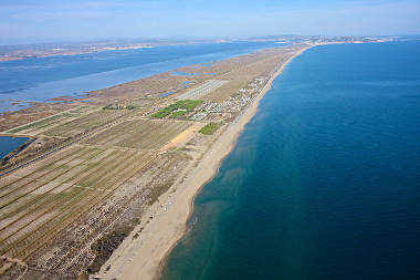
Data from the 'Littoral and shoreline observatory' (LTC): Coastline observation and coastal hydro-morphodynamics (swell, submersion, sediment transport, ...) and coralligenous reefs monitoring in the Mediterranean.. This observatory is part of the Montpellier Research Observatory of Environment (OSU OREME, oreme.org). It is labelized in the framework of SNO DYNALIT. It consists in different observing tasks: BEACH-OBS.
-
Pluviometry data from the Larzac observatory (SO GEK) hosted by the Mediterranean Research Observatory of Environment (OSU OREME, http://www.oreme.org) and the National hydrogeological sites network (SNO H+, http://hplus.ore.fr/). Data are measured on La Blaquererie site (LA COUVERTOIRADE, AVEYRON, France) and La Jasse site (L'HOSPITALET-DU-LARZAC, AVEYRON, France) and La Salvetat site (LA COUVERTOIRADE, AVEYRON, France).
-
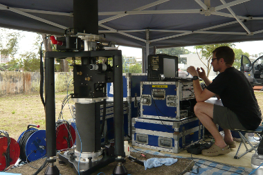
Data from the 'Measurement of crustal deformation by GNSS' (GNSS): Different networks of permanent and semi-permanent GNSS stations.. This observatory is part of the Montpellier Research Observatory of Environment (OSU OREME, oreme.org). It is labelized in the framework of SNO RESIF-RENAG.